

You can still work up a sweat, get lost in nature, or hike to an epic view without ever leaving the city. These are the best hikes in San Francisco.
Some of California’s best hiking is within an hour or two of San Francisco, especially if you’re partial to redwoods like me. In fact, the Santa Cruz Mountains, which lie just south of the city on the peninsula, are home to five California state parks with some of the oldest and largest redwood trees on earth.
But, you can stay within the limits of San Francisco and still find trails that lead you through groves of eucalyptus, up to hill tops with stunning city views, and out to epic viewpoints overlooking the ocean. After sticking close to home for much of the last year, we’ve rounded up the best hikes in San Francisco for you to explore.
Note: This post contains affiliate links. This means if you click on one of them, we may receive a small commission at no additional cost to you. For more information, read our full disclosure.
What to bring with you on a San Francisco hike
Water Bottle: Make sure to fill up your reusable water bottle before you head out on a trail. These Nalgene bottle are great, and I’ve also been loving the self-cleaning LARQ bottle. The UV-C LED technology in the lid activates every two hours to kill 99.99% of harmful bacteria and viruses, keeping your water clean and your water bottle smelling good.
Hiking Shoes: Most of these trails are pretty short and easy, but they can get muddy. It’s a good idea to have a shoe with some decent tread (though traditional hiking boots would be definite overkill). I’m a fan of minimalist hiking shoes from Lems; they’re comfortable and work great for both nature and city walks. You can see more of my favorite hiking shoes here.
Jacket: San Francisco weather can vary from neighborhood to neighborhood and hour to hour, so it’s always a good idea to have at least a lightweight jacket on hand. The Patagonia Nano Puff is a winner because it’s lightweight but warm, packs down small so it’s easy to toss in your backpack, and it’s made from sustainable materials (check out some of our favorite eco-conscious outdoor companies here).


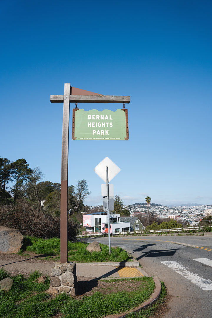
Find some of the best views of downtown San Francisco at Bernal Heights Park
Best Hikes in San Francisco
San Francisco Hikes along the Coast
You’d be remiss to visit San Francisco and not break out of popular tourist spots like Fisherman’s Wharf or Union Square. San Francisco is lucky enough to have both amazing bay and ocean views, with several hiking trails right along the coast. These San Francisco hikes feature views of the Pacific Ocean, the Golden Gate Bridge, and San Francisco’s diverse coastline.
1 Batteries to Bluffs Trail
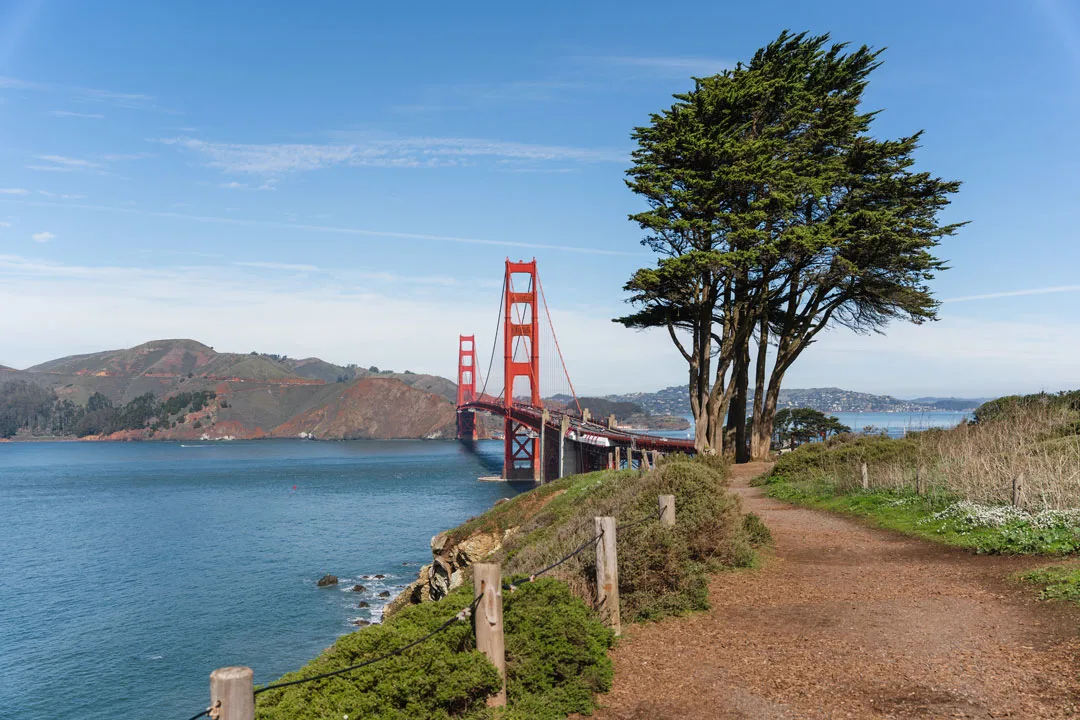
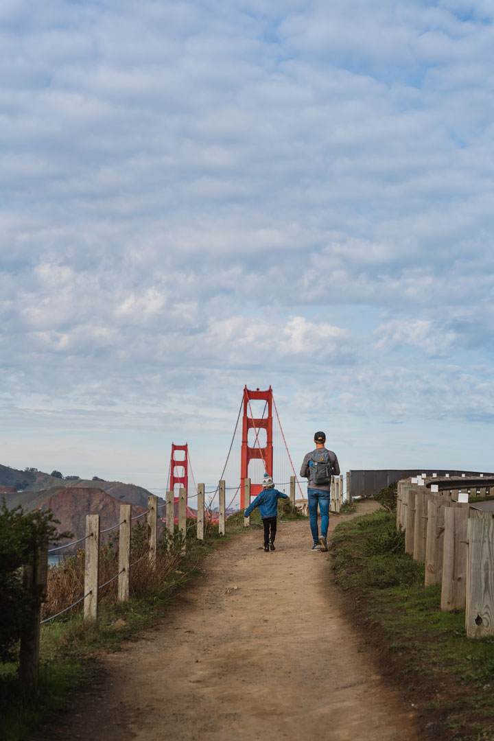
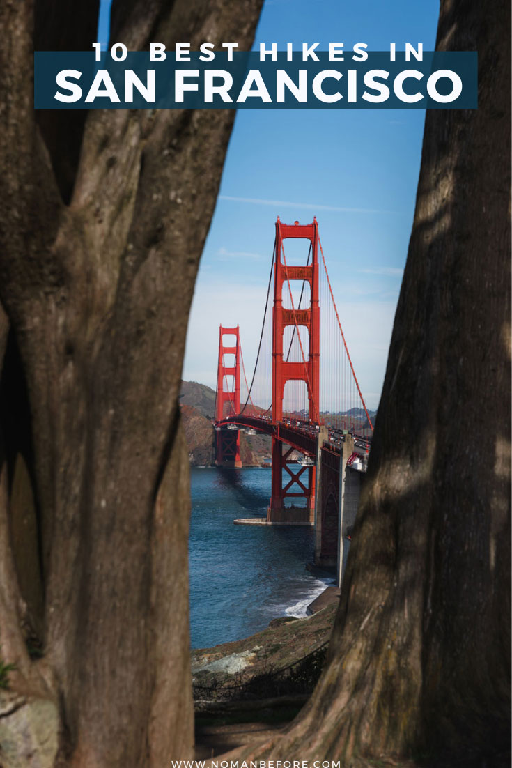
I’d recommend anyone visiting San Francisco for the first time include the Batteries to Bluffs Trail on their itinerary. This walking trail gives you some of the absolute best views of the Golden Gate Bridge. It also includes remnants of San Francisco’s military history as you pass through several batteries and includes a stop at Marshall’s Beach.
This trail runs from the Golden Gate Bridge down to Baker Beach, so you can start at either end, making a stop at Marshall’s Beach along the way. Because this trail starts at the top of the bluffs and makes its way down to the beach, you get some good elevation gain in a short period of time. Most of this is accomplished by a number of wooden staircases built into the trail.


If you opt to take the outer portion of the loop back up to the Golden Gate Bridge, you’ll stay on top of the bluff (so there is only a slight incline) and follow the California Coastal Trail along the road.
Distance: 2.2 mile loop. See trail map here.
Parking: If you’re starting near the Golden Gate Bridge, free parking is available at Landon Court Parking, which is a dirt lot in front of the Golden Gate Overlook and just off of Lincoln Blvd. There’s also a small free lot just a minute more down the road on Merchant Rd. Both of these are marked on the map. There are several paid parking lots in the area, including the Stone St Parking lot on the other side of Lincoln Blvd.
You can also park at Baker Beach and take the California Coastal trail along the beach until you meet up with the Batteries to Bluffs Trail once you pass the sand ladder.


2 Land’s End Trail
Land’s End is where San Francisco’s natural, rugged shoreline curves from the Pacific Ocean and into the Bay. This area is often windy, so make sure to bring a jacket!
The easiest place to start and end the Land’s End Trail is at the Sutro Baths. Here you’ll find free parking, bathrooms, water fountains, and some of San Francisco’s most famous ruins. While only the concrete outlines of the old pools remain, the Sutro Baths were once an extravagant public bathhouse that contained seven different swimming pools and could fit up to 10,000 people. They were built in 1894, lost popularity around the Great Depression, and the buildings were eventually completely destroyed by fire in 1866.
The Land’s End trail follows an old electric streetcar line that ran along the coast from 1905 to 1925. The track was washed out by heavy rains and deemed too expensive to rebuild. The current trail is wide, flat, and mostly stroller friendly. On a clear day, there are beautiful views of the Golden Gate Bridge.
You can take a few detours off the main trail, including the set of stairs about three quarters of a mile in to Mile Rock Beach and the Land’s End Labyrinth, a rock art creation by artist Eduardo Aguilera.
Distance: 3.4 mile loop. See trail map here.
Parking: The easiest place to park for Land’s End is at the Sutro Baths. This is a popular area on weekends, so come early or be prepared to wait for a parking spot to open up.


3 Fort Funston Coastal Trail
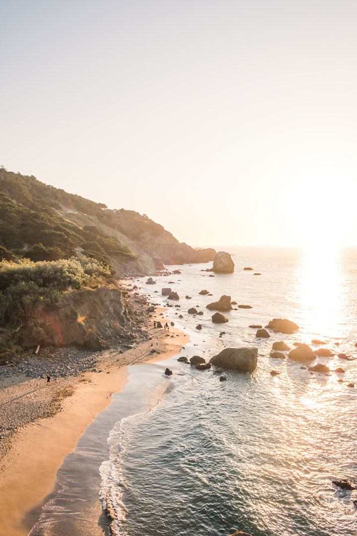
Follow the coast down the massively long and flat Ocean Beach, and you’ll eventually see the coastline rise up into towering bluffs again at Fort Funston. This area is famously windy, making the tops of the bluffs a popular place for hang gliders to launch and land. The best time to see gliders in action is March through October.
The two-mile roundtrip trail stays on top of the bluffs, though you can take the sand ladder to the south of the parking lot down to the beach.
Distance: 2 mile loop. See trail map here.
Parking: Free parking is available at the Fort Funston Southern Parking Lot
San Francisco Hikes in the Trees
4 Presidio Ecology Trail and Lover’s Lane
The Presidio served as a military post from 1776 until 1994, when it became part of the Golden Gate National Recreation Area and operated by the National Park Service. With over 1,500 acres of land, there is so much to explore. Within the Presidio there are miles of trails, over 700 historical buildings, and several museums.
One of the most popular spots in the Presidio and urban hikes in San Francisco is Lover’s Lane. It’s the oldest footpath through the Presidio, and right next to Andy Goldsworthy’s art installation, Wood Line. This part of the trail takes you through the towering eucalyptus, but parts of the path are also paved.
Distance: 2 mile loop. See trail map here.
Parking: There is a small lot at the start of the trailhead off of Pacific Ave. You can also look for street parking in the residential area bordering the south east corner of the Presidio.


5 Stern Grove
Stern Grove is a 33-acre park in the Sunset District known for its towering eucalyptus, a natural lake, and host to one of the most popular summer music festivals in San Francisco known as the Stern Grove Festival. For a quick, easy, and dog-friendly trail, take the approximately 2 mile loop around the park and Pine Lake.
Distance: 2 mile loop. See trail map here.
Parking: There are two small lots located within the park – Stern Grove Entry Rd Parking and the Vale Ave Parking lot. There is also street parking available near the park’s entrances
6 Mt Sutro
Mt Sutro once looked like many of San Francisco’s grassy hills, but was transformed into a forest of eucalyptus, cypress and pine when former San Francisco Mayer Adolph Sutro started planting trees in 1886 to celebrate Arbor Day. Mt Sutro is also in one of the foggiest parts of the city. The combination of the trees and the mist make it feel like you’re being transported out of the city and into a remote cloud forest.
Distance: 2 mile loop. See trail map here.
Parking: There is no designated parking, so you’ll have to find street parking near an entrance or take public transit.
7 Glen Canyon Park
This quick and easy local trail takes you through a small canyon between two neighborhoods. The canyon features one of the few free-flowing creeks left in San Francisco, Islais Creek. Find easy access to the trail near Crags Court Community Garden.
Distance: 1.8 mile loop. See trail map here.
Parking: Find street parking in the surrounding neighborhood
Hikes with the Best views of the City
8 Twin Peaks
At 922 feet, Twin Peaks ties for the second highest hills in San Francisco after Mt. Davidson. Twin Peaks is located right in the middle of the city, and the top offers some of the best panoramic views of San Francisco. I love coming here to see the sunset over the ocean on one side, and downtown drenched in beautiful hues of pinks and blues on the other.
You can drive most of the way to the top, or make it more a bit of a hike by starting at the trailhead at Clarendon Avenue. There are several sets of stairs, so it’s great if you want to get your heart pumping. From the Clarendon trailhead, it’s a 2.1 mile out and back trail that loops around both peaks.
Twin Peaks seems to be the windiest spot in all of San Francisco, so you’re definitely going to want a jacket here! All the times I’ve been up here I’ve felt like I was about to get blown away, even if there wasn’t any wind in the neighborhood below.
Distance: 2.1 mile out and back trail. See trail map here.
Parking: Street parking off of Crestline Drive. There is also a small parking lot located near Christmas Tree Point on the north peak.


9 Mount Davidson
Near the center of San Francisco lies the highest hill in the city, Mount Davidson. There are several trails that wind up the eucalyptus-forested hill to the top, where you’ll find panoramic views of the city and a 103-foot concrete cross. The cross commemorates the Armenian Genocide and is the site of an annual Easter prayer service.
Distance: 1 mile loop. Find trail map here.
Parking: Street parking in the surrounding neighborhood


10 Bernal Heights Park
There are a number or trails leading up to the top of Bernal Hill. All will reward you with 360-degree views of San Francisco. To the north, you’ll have a great view of downtown and the bay beyond. The main trail is a large, wide path about 1 mile long that loops up and around to the top. You can veer off on any of the smaller, steeper trails for a more direct route. There used to be a swing hanging from one of the large trees at the top, but as of February 2021 the swing was no longer there.
Distance: 1 mile loop
Parking: There is a very small lot that fits about 4 cars, or you can find street parking nearby.


Like this post? Pin it here!

Katie
Tuesday 24th of January 2023
Bernal heights is such a special place. I could spend an entire day just wandering the many staircases that lead from the neighborhood into the park.
San Francisco Maritime National Historic Park: Tips for Touring the Ships at Hyde Street Pier
Monday 9th of August 2021
[…] Visiting San Francisco? We’ve lived in the Bay Area for the last two years and love exploring locally. Check out some of our favorites hikes while you’re in the city! […]
Go Wander Wild
Wednesday 2nd of June 2021
This guide to hiking in San Francisco is incredibly helpful. You’ve really thought through everything you need to know before planning a trip. Thank you for this helpful resource. Saving this guide for later!
nomanbefore
Wednesday 9th of June 2021
So glad you found it helpful!
Portia Jones
Sunday 28th of March 2021
Oh my gosh, this is such a comprehensive guide and your photos are so gorgeous. I’m definitely pinning this for future travel inspiration.
Samantha
Saturday 27th of March 2021
Love these ideas! I found the Ft Funston Trail to be a really cool one, I'd love to check out some more when visiting the area!
nomanbefore
Saturday 27th of March 2021
It's so fun to watch the hang gliders on a windy day!